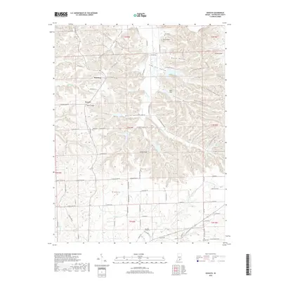
2019 Map of Kossuth
USGS Topo · Published 2019About this map
Plattsburg and Kossuth sit within a landscape of deeply carved drainages and prominent ridges in northern Washington County. The area's topography is defined by significant landmarks like Potato Knob and Johnson Knob, with numerous hollows such as Mandy Hollow, Spurgeon Hollow, and the colorfully named Lick Skillet Hollow feeding into larger water bodies like the W Fork Blue River. This modern survey illustrates how long-established rural settlements and family burial grounds remain integral to the community fabric. Genealogists will find a high density of small cemeteries, including Blue River Friends Cem, Collett Cem, and Gater Cem, scattered across the township lines. The winding route of the Knobstone Trail / Backcountry Trail traverses the eastern ridges, following the elevation contours past Deep Gap and through the timbered reaches of the Hoosier landscape.
Find a feature on this map
88 named features on this map. Tap any name to fly to it.
Don’t see what you’re looking for? This feature index may not catch every label — zoom into the map to look around manually.
Map Details
Editions of this 2019 Kossuth Map
This is the sole edition of this map. No revisions or reprints were ever made.
Other maps of this area

1950 · Salem
USGS Topo · 1:24,000

1950 · Becks Mill
USGS Topo · 1:24,000

1951 · Smedley
USGS Topo · 1:24,000

1953 · Kossuth
USGS Topo · 1:24,000

1955 · South Boston
USGS Topo · 1:24,000

1956 · Vincennes
USGS Topo · 1:250,000

1956 · Louisville
USGS Topo · 1:250,000

1957 · Vincennes
USGS Topo · 1:250,000

1958 · Vincennes
USGS Topo · 1:250,000

1958 · Little York
USGS Topo · 1:24,000