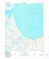
1950 Map of Kotzebue A-4
USGS Topo · Published 1982About this map
Bering Land Bridge National Preserve encompasses the southern portion of this landscape, marking a terrain defined by complex hydrological systems and coastal inlets. Derived from 1949 aerial photography, the map captures the wilderness of the Seward Peninsula at a time when the Goodhope River and Pish River remained the primary landmarks across the tundra. The drainage patterns shown here, including Eagle Creek and Pot Creek, suggest a landscape shaped by seasonal melt and permafrost dynamics. The vast expanse of Goodhope Bay and Kotzebue Sound dominate the northern half, illustrating the region's total reliance on maritime and riverine geography. This document provides a record of the area's natural state before modern administrative boundaries were fully established, highlighting the remote character of the Northwest Arctic coastline.
Find a feature on this map
11 named features on this map. Tap any name to fly to it.
Don’t see what you’re looking for? This feature index may not catch every label — zoom into the map to look around manually.
Map Details
Editions of this 1950 Kotzebue A-4 Map
3 editions found
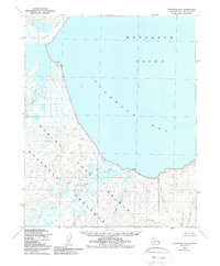
Other maps of this area

1950 · Bendeleben D-5
USGS Topo · 1:63,360

1950 · Bendeleben
USGS Topo · 1:250,000

1950 · Bendeleben D-3
USGS Topo · 1:63,360

1950 · Bendeleben D-4
USGS Topo · 1:63,360

1950 · Kotzebue B-4
USGS Topo · 1:63,360

1950 · Kotzebue B-5
USGS Topo · 1:63,360

1950 · Kotzebue A-4
USGS Topo · 1:63,360

1950 · Kotzebue A-5
USGS Topo · 1:63,360

1950 · Kotzebue A-3
USGS Topo · 1:63,360

1951 · Bendeleben
USGS Topo · 1:250,000