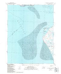
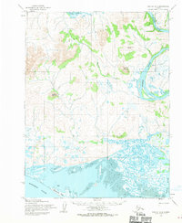
1951 Map of Kotzebue D-2
USGS Topo · Published 1988About this map
Kotzebue serves as the focal point of this coastal landscape, situated on the western tip of the Baldwin Peninsula where the waters of Kotzebue Sound dominate the geography. This mid-century view, updated with late-1980s hydrographic and boundary data, shows the town's critical aviation infrastructure including the Ralph Wein Memorial Aerodrome, the Municipal Airport, and a CAA Station. To the north, across the sound, the Sheshalik Spit and the settlement of Sheshalik mark the entrance to the Cape Krusenstern National Monument.
Find a feature on this map
29 named features on this map. Tap any name to fly to it.
Don’t see what you’re looking for? This feature index may not catch every label — zoom into the map to look around manually.
Map Details
Editions of this 1951 Kotzebue D-2 Map
3 editions found
Other maps of this area

1951 · Noatak
USGS Topo · 1:250,000

1951 · Kotzebue
USGS Topo · 1:250,000

1951 · Kotzebue D-1
USGS Topo · 1:63,360

1951 · Kotzebue D-2
USGS Topo · 1:63,360
1951 · Kotzebue C-1
USGS Topo · 1:63,360

1952 · Noatak A-3
USGS Topo · 1:63,360

1955 · Noatak
USGS Topo · 1:250,000
1955 · Noatak A-1
USGS Topo · 1:63,360
1955 · Noatak A-2
USGS Topo · 1:63,360

1958 · Kotzebue
USGS Topo · 1:250,000