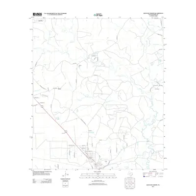
2013 Map of Kountze North
USGS Topo · Published 2013About this map
Village Cr and its numerous tributaries, including Hickory Cr and Turkey Cr, define the drainage patterns of this Hardin County landscape. The area is characterized by a mix of industrial resource extraction and quiet rural burial grounds, with the East Village Mills Oil Field occupying the northwestern reaches. Family and community heritage is preserved at several local sites such as McNeely Cem, William W. Hart Cem, and Olive Cem.
Find a feature on this map
73 named features on this map. Tap any name to fly to it.
Don’t see what you’re looking for? This feature index may not catch every label — zoom into the map to look around manually.
Map Details
Editions of this 2013 Kountze North Map
This is the sole edition of this map. No revisions or reprints were ever made.
Other maps of this area

1954 · Beaumont
USGS Topo · 1:250,000

1955 · Silsbee
USGS Topo · 1:62,500

1955 · Kountze
USGS Topo · 1:62,500

1957 · Beaumont
USGS Topo · 1:250,000

1958 · Warren
USGS Topo · 1:62,500

1958 · Spurger
USGS Topo · 1:62,500

1984 · Beaumont
USGS Topo · 1:250,000
1984 · Silsbee
USGS Topo · 1:24,000
1984 · Kountze South
USGS Topo · 1:24,000
1984 · Warren
USGS Topo · 1:24,000