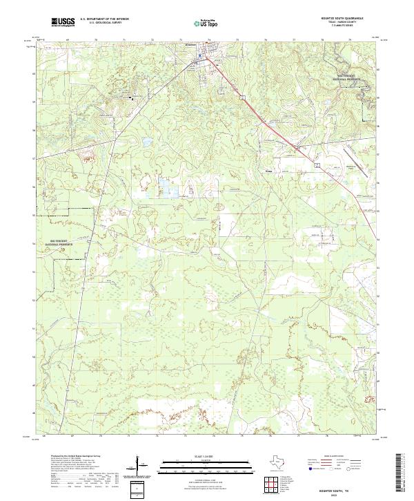
2022 Map of Kountze South
USGS Topo · Published 2022About this map
Kountze serves as the focal point of this Hardin County landscape, situated at the edge of the Big Thicket National Preserve. The town layout is anchored by the Hardin County Courthouse, with streets such as W Monroe St and Pecan St defining the local geography. To the west, the preservation of the Big Thicket maintains the native piney woods character, while drainage networks like Cypress Cr and Village Creek carve through the terrain. Genealogists will find particular value in the documentation of the Old Hardin Cem and Wheeler Cem, which are accessible via Old Cemetery Rd. These burial sites, along with the settlement at Nona, provide a framework for tracing the lineage of local families in this portion of Southeast Texas. The intricate web of local routes, including FM 1293 and Vaughn St, illustrates the ongoing integration of residential areas with the surrounding natural environment.
Find a feature on this map
77 named features on this map. Tap any name to fly to it.
Don’t see what you’re looking for? This feature index may not catch every label — zoom into the map to look around manually.
Map Details
Editions of this 2022 Kountze South Map
This is the sole edition of this map. No revisions or reprints were ever made.
Other maps of this area

1932 · Beaumont
USGS Topo · 1:62,500

1954 · Beaumont
USGS Topo · 1:250,000

1955 · Silsbee
USGS Topo · 1:62,500

1955 · Kountze
USGS Topo · 1:62,500

1955 · Sour Lake
USGS Topo · 1:62,500

1957 · Beaumont
USGS Topo · 1:250,000
1960 · Voth
USGS Topo · 1:24,000

1984 · Beaumont
USGS Topo · 1:250,000

1984 · Sour Lake
USGS Topo · 1:24,000
1984 · Bevil Oaks
USGS Topo · 1:24,000