
1984 Map of Sour Lake
USGS Topo · Published 1985About this map
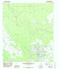
Sour Lake serves as the focal point of this Hardin County survey, highlighting the intersection of deep-rooted Texas oil industry and protected coastal plains. The southern portion of the map is dominated by a dense Oil Field and the adjacent settlement of Grayburg, illustrating the area's continued reliance on petroleum extraction. Northward, the landscape shifts into the conservation lands of the Big Thicket National Preserve, where Little Pine Island Bayou snakes through the terrain alongside numerous seasonal waterways like Yearling Tick Branch and Pignut Gully.
Find a feature on this map
19 named features on this map. Tap any name to fly to it.
Don’t see what you’re looking for? This feature index may not catch every label — zoom into the map to look around manually.
Map Details
Editions of this 1984 Sour Lake Map
2 editions found
Other maps of this area

1943 · Liberty
USGS Topo · 1:125,000

1954 · Beaumont
USGS Topo · 1:250,000

1955 · Daisetta
USGS Topo · 1:62,500

1955 · Saratoga
USGS Topo · 1:62,500

1955 · Kountze
USGS Topo · 1:62,500

1955 · Sour Lake
USGS Topo · 1:62,500

1957 · Beaumont
USGS Topo · 1:250,000

1984 · Beaumont
USGS Topo · 1:250,000
1984 · Nome
USGS Topo · 1:24,000
1984 · Bevil Oaks
USGS Topo · 1:24,000