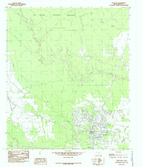
1984 Map of Sour Lake
USGS Topo · Published 1985About this map
Sour Lake serves as the primary hub of this Hardin County landscape, situated just north of Grayburg at the edge of the sprawling Big Thicket National Preserve. The town's economic foundations are evident in the extensive Oil Field infrastructure and numerous pipelines that crisscross the prairie, reflecting the region's long-standing petroleum industry. Beyond the industrial zones, the map reveals a complex hydrology of lowlands and bayous, including Little Pine Island Bayou and Jackson Creek.
Find a feature on this map
22 named features on this map. Tap any name to fly to it.
Don’t see what you’re looking for? This feature index may not catch every label — zoom into the map to look around manually.
Map Details
Editions of this 1984 Sour Lake Map
2 editions found
Other maps of this area

1943 · Liberty
USGS Topo · 1:125,000

1954 · Beaumont
USGS Topo · 1:250,000

1955 · Daisetta
USGS Topo · 1:62,500

1955 · Saratoga
USGS Topo · 1:62,500

1955 · Kountze
USGS Topo · 1:62,500

1955 · Sour Lake
USGS Topo · 1:62,500

1957 · Beaumont
USGS Topo · 1:250,000

1984 · Beaumont
USGS Topo · 1:250,000
1984 · Nome
USGS Topo · 1:24,000

1984 · Sour Lake
USGS Topo · 1:24,000