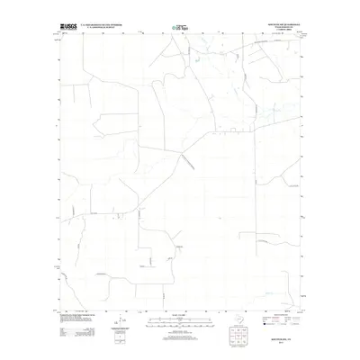
2013 Map of Kountze SW
USGS Topo · Published 2013About this map
Big Thicket National Preserve anchors the center of this landscape in Hardin County, where the dense coastal plains of southeast Texas are defined by the winding paths of Cypress Cr and its northern tributary, Flat Cypress Cr. The map reveals a transition from natural protected areas to a network of rural roads that likely reflect long-standing property divisions and family landholdings. Local thoroughfares like Sam Brown Rd, Elmer Rd, and Gannon Rd intersect the terrain south of the preserve, while Old Honey Island Rd traces the northern edge of the sheet. The drainage pattern is rounded out by Black Cr in the southeastern corner, illustrating the intricate hydrology of the Piney Woods region in the early twenty-first century. This survey documents the intersection of conservation land and rural development, providing a clear record of the area's infrastructure before subsequent changes in land use.
Find a feature on this map
24 named features on this map. Tap any name to fly to it.
Don’t see what you’re looking for? This feature index may not catch every label — zoom into the map to look around manually.
Map Details
Editions of this 2013 Kountze SW Map
This is the sole edition of this map. No revisions or reprints were ever made.
Other maps of this area

1943 · Liberty
USGS Topo · 1:125,000

1954 · Beaumont
USGS Topo · 1:250,000

1955 · Daisetta
USGS Topo · 1:62,500

1955 · Saratoga
USGS Topo · 1:62,500

1955 · Kountze
USGS Topo · 1:62,500

1955 · Sour Lake
USGS Topo · 1:62,500

1957 · Beaumont
USGS Topo · 1:250,000

1984 · Beaumont
USGS Topo · 1:250,000

1984 · Sour Lake
USGS Topo · 1:24,000
1984 · Bevil Oaks
USGS Topo · 1:24,000