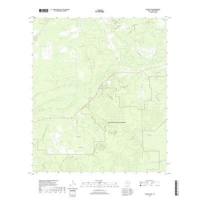
2019 Map of Kountze SW
USGS Topo · Published 2019About this map
Big Thicket National Preserve dominates this portion of the East Texas piney woods, protecting a network of wetlands and waterways in Hardin County. The landscape is defined by the drainage of Cypress Creek and Flat Cypress Creek in the north, while Black Creek meanders through the southern reaches. This modern survey illustrates the conservation boundaries that overlap with local transportation routes, showing how the area is managed as a protected ecosystem. Rural roads such as Old Honey Island Rd and Cash Rd connect scattered residences and agricultural tracts to larger thoroughfares like FM 1003. The presence of numerous wetland markers across the map reflects the low-lying, hydric nature of the terrain characteristic of the Big Thicket region, providing a detailed look at the land use and natural hydrography of the area.
Find a feature on this map
18 named features on this map. Tap any name to fly to it.
Don’t see what you’re looking for? This feature index may not catch every label — zoom into the map to look around manually.
Map Details
Editions of this 2019 Kountze SW Map
This is the sole edition of this map. No revisions or reprints were ever made.
Other maps of this area

1943 · Liberty
USGS Topo · 1:125,000

1954 · Beaumont
USGS Topo · 1:250,000

1955 · Daisetta
USGS Topo · 1:62,500

1955 · Saratoga
USGS Topo · 1:62,500

1955 · Kountze
USGS Topo · 1:62,500

1955 · Sour Lake
USGS Topo · 1:62,500

1957 · Beaumont
USGS Topo · 1:250,000

1984 · Beaumont
USGS Topo · 1:250,000

1984 · Sour Lake
USGS Topo · 1:24,000
1984 · Bevil Oaks
USGS Topo · 1:24,000