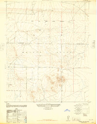
1947 Map of Kramer SW
USGS Topo · Published 1947About this map
Muroc Army Airfield Military Reservation dominates the northern reaches of this landscape, a significant installation established during the post-war expansion of military aviation. Situated where the Antelope Valley meets the Mojave Desert, the area is characterized by vast arid stretches and isolated landforms like Jackrabbit Hill. The map documents a specific moment when the desert was being utilized for intensive flight operations, indicated by a designated Target area north of the primary airfield boundary.
Find a feature on this map
7 named features on this map. Tap any name to fly to it.
Don’t see what you’re looking for? This feature index may not catch every label — zoom into the map to look around manually.
Map Details
Editions of this 1947 Kramer SW Map
3 editions found
Other maps of this area

1931 · Adobe
USGS Topo · 1:24,000

1931 · Hi Vista
USGS Topo · 1:24,000

1934 · Adobe
USGS Topo · 1:24,000

1935 · Hi Vista
USGS Topo · 1:24,000

1937 · Shadow Mountains
USGS Topo · 1:48,000

1937 · Kramer
USGS Topo · 1:48,000

1937 · Rogers Lake
USGS Topo · 1:48,000

1942 · Kramer
USGS Topo · 1:62,500

1942 · Shadow Mountains
USGS Topo · 1:62,500

1942 · Rogers Lake
USGS Topo · 1:62,500