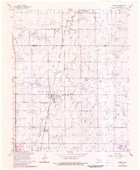
1968 Map of Kremlin
USGS Topo · Published 1983About this map
Kremlin serves as the focal point of this Garfield County landscape, situated along the Kansas and Texas Oklahoma railroad corridor. The area's mid-century economic profile is defined by extensive energy extraction and industrial activity, notably within the East Kremlin Gas Field and at the Carbon Plant south of town. Several Oil Wells and Gas Wells dot the terrain, which is drained by Horse Creek and Sand Creek. Cultural landmarks such as the Kremlin Cem and the more northern Valley Center Cem provide valuable points of reference for genealogists. The presence of the Zaloudek Landing Strip alongside the rail line highlights the region's reliance on specialized transportation and infrastructure during the 1960s and 1980s. Fine red dashed lines throughout the survey indicate field and fence lines, offering a glimpse into the agricultural boundaries of the era.
Find a feature on this map
26 named features on this map. Tap any name to fly to it.
Don’t see what you’re looking for? This feature index may not catch every label — zoom into the map to look around manually.
Map Details
Editions of this 1968 Kremlin Map
2 editions found
Other maps of this area

1955 · Enid West
USGS Topo · 1:24,000

1955 · Enid East
USGS Topo · 1:24,000

1955 · Enid
USGS Topo · 1:250,000

1956 · Garber
USGS Topo · 1:62,500

1956 · Enid
USGS Topo · 1:62,500

1958 · Enid
USGS Topo · 1:250,000

1968 · Hillsdale
USGS Topo · 1:24,000

1968 · Lamont NW
USGS Topo · 1:24,000

1968 · Hunter
USGS Topo · 1:24,000

1968 · Kremlin
USGS Topo · 1:24,000