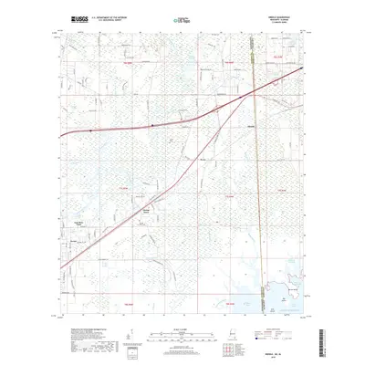
2018 Map of Kreole
USGS Topo · Published 2018About this map
The Escatawpa River defines the western reaches of this coastal landscape, winding southward toward the Gulf of Mexico. Along the Mississippi and Alabama state line, small settlements like Missala and Pecan sit near the crossing of the Franklin Cr and Black Creek drainages. The map reveals a dense network of coastal bayous and islands, including Barton Island and Big Island situated within Grand Bay.
Find a feature on this map
107 named features on this map. Tap any name to fly to it.
Don’t see what you’re looking for? This feature index may not catch every label — zoom into the map to look around manually.
Map Details
Editions of this 2018 Kreole Map
This is the sole edition of this map. No revisions or reprints were ever made.
Other maps of this area

1921 · Grand Bay
USGS Topo · 1:62,500

1941 · Hurley
USGS Topo · 1:62,500

1941 · Vancleave
USGS Topo · 1:62,500

1943 · Pascagoula
USGS Topo · 1:62,500

1943 · Grand Bay
USGS Topo · 1:62,500

1943 · Hurley
USGS Topo · 1:62,500

1943 · Vancleave
USGS Topo · 1:62,500

1944 · Vancleave
USGS Topo · 1:62,500

1953 · Mobile
USGS Topo · 1:250,000

1955 · Pascagoula
USGS Topo · 1:62,500