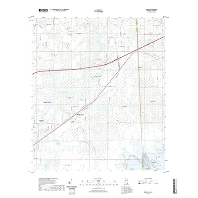
2020 Map of Kreole
USGS Topo · Published 2020About this map
Moss Point and its eastern suburbs sit at the heart of this coastal Jackson County landscape, where the Escatawpa River winds through a dense network of wetlands and bayous. The 2020 geography reveals the sprawling residential character of Orange Grove and Kreole, bounded by the transition from riverine plains to the open waters of Middle Bay and Grand Bay. In the northern reaches, timbered terrain and small settlements like Pecan and Missala dot the area near the Mississippi-Alabama border. Genealogists will find several burial grounds noted, including Orange Grove Cem, Kivisto Cem, and Finland Cemetery RD E. The southern margin is dominated by an intricate aquatic system of marshland and islands, such as Barton Island and Big Island, where Southwest Bayou and Mattie Clark Bayou define the tidal reach of the Gulf coast.
Find a feature on this map
109 named features on this map. Tap any name to fly to it.
Don’t see what you’re looking for? This feature index may not catch every label — zoom into the map to look around manually.
Map Details
Editions of this 2020 Kreole Map
This is the sole edition of this map. No revisions or reprints were ever made.
Other maps of this area

1921 · Grand Bay
USGS Topo · 1:62,500

1941 · Hurley
USGS Topo · 1:62,500

1941 · Vancleave
USGS Topo · 1:62,500

1943 · Pascagoula
USGS Topo · 1:62,500

1943 · Grand Bay
USGS Topo · 1:62,500

1943 · Hurley
USGS Topo · 1:62,500

1943 · Vancleave
USGS Topo · 1:62,500

1944 · Vancleave
USGS Topo · 1:62,500

1953 · Mobile
USGS Topo · 1:250,000

1955 · Pascagoula
USGS Topo · 1:62,500