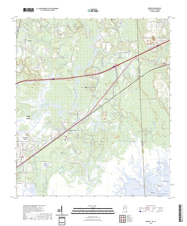
2024 Map of Kreole
USGS Topo · Published 2024About this map
The Grand Bay National Wildlife Refuge dominates the coastal landscape along the Mississippi-Alabama border, preserving an intricate network of tidal marsh and maritime forest. In this corner of Jackson and Mobile Counties, the transition from the pine flatwoods to the Gulf of Mexico is defined by winding water bodies like the Escatawpa River, Bayou Cumbest, and Bayou Heron. Settlement patterns are concentrated toward the west near Moss Point and Kreole, while smaller communities such as Orange Grove and Pecan are situated along the historic road and rail corridors that parallel the coastline.
Find a feature on this map
115 named features on this map. Tap any name to fly to it.
Don’t see what you’re looking for? This feature index may not catch every label — zoom into the map to look around manually.
Map Details
Editions of this 2024 Kreole Map
This is the sole edition of this map. No revisions or reprints were ever made.
Other maps of this area

1921 · Grand Bay
USGS Topo · 1:62,500

1941 · Hurley
USGS Topo · 1:62,500

1941 · Vancleave
USGS Topo · 1:62,500

1943 · Pascagoula
USGS Topo · 1:62,500

1943 · Grand Bay
USGS Topo · 1:62,500

1943 · Hurley
USGS Topo · 1:62,500

1943 · Vancleave
USGS Topo · 1:62,500

1944 · Vancleave
USGS Topo · 1:62,500

1953 · Mobile
USGS Topo · 1:250,000

1955 · Pascagoula
USGS Topo · 1:62,500