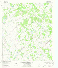
1963 Map of Kurten
USGS Topo · Published 1980About this map
Kurten and the surrounding Brazos County countryside are defined by a network of small family cemeteries and rural school sites that speak to the area’s deep agricultural roots. Settlement is concentrated around nodes like Union, Cottonwood, and Tabor, where community life centered on landmarks like Cottonwood Ch and Zion Ch. The landscape is crisscrossed by a dense drainage system including Wickson Creek, Mathis Creek, and Jack Creek, many of which flow through the distinctive String Prairie region. This survey also records numerous flowing wells, indicating a reliance on artesian water sources for local farmsteads. Genealogists will find particular value in the sheer density of burial grounds captured here, ranging from the Bickham Cem to the family-named Jim Harris Cem and Evans Cem.
Find a feature on this map
60 named features on this map. Tap any name to fly to it.
Don’t see what you’re looking for? This feature index may not catch every label — zoom into the map to look around manually.
Map Details
Editions of this 1963 Kurten Map
2 editions found
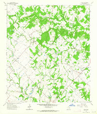
Other maps of this area

1925 · Iola No 2
USGS Topo · 1:48,000

1931 · Iola
USGS Topo · 1:62,500

1954 · Austin
USGS Topo · 1:250,000

1956 · Bryan
USGS Topo · 1:62,500

1956 · Carlos
USGS Topo · 1:62,500

1959 · Clear Lake
USGS Topo · 1:24,000

1959 · Reliance
USGS Topo · 1:24,000

1962 · Edge
USGS Topo · 1:24,000

1962 · Wheelock
USGS Topo · 1:24,000

1962 · Bryan East
USGS Topo · 1:24,000