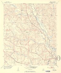
1953 Map of Kushla
USGS Topo · Published 1954About this map
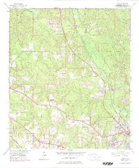
Chickasaw Creek snakes through this portion of Mobile County, providing a central drainage for numerous tributaries like Seabury Creek and Magee Creek. The landscape in the early 1950s is defined by a series of small, interconnected settlements and numerous rural congregations, including Mt Pilgrim Ch and Mt Otter Ch. The Gulf Mobile and Ohio railroad corridor serves as a primary transit axis, running parallel to the creek and connecting the community of Kushla with Mauvilla to the northwest.
Find a feature on this map
33 named features on this map. Tap any name to fly to it.
Don’t see what you’re looking for? This feature index may not catch every label — zoom into the map to look around manually.
Map Details
Editions of this 1953 Kushla Map
6 editions found
Other maps of this area

1922 · Mobile
USGS Topo · 1:62,500

1940 · Mobile
USGS Topo · 1:31,680

1940 · Mobile
USGS Topo · 1:62,500

1941 · Chickasaw
USGS Topo · 1:31,680

1941 · Hurley
USGS Topo · 1:62,500

1941 · Creola
USGS Topo · 1:62,500

1942 · Kushla
USGS Topo · 1:31,680

1942 · Wilmer
USGS Topo · 1:62,500

1943 · Creola
USGS Topo · 1:62,500

1943 · Chickasaw
USGS Topo · 1:31,680