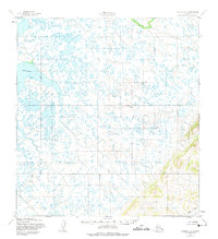
1952 Map of Kwiguk C-3
USGS Topo · Published 1974About this map
Nanvaranak Lake dominates the northwestern landscape of this subarctic coastal region, a vast expanse defined by thousands of small, unnamed ponds and intricate wetlands. The drainage patterns are dictated by the meandering Pastolik River, which winds across the Seward Meridian in a complex series of oxbows and bifurcated channels. The absence of roads or trails in this 1952 study underscores the seasonal nature of this environment, where water and ice are the primary corridors for movement. In the southeastern corner, the terrain shifts abruptly as the flat alluvial plain meets more elevated relief near Allen Creek. Mapping by the Army Map Service reveals a landscape largely untouched by permanent industrial or urban infrastructure, preserving the hydrography of the Alaskan tundra in its mid-century state.
Find a feature on this map
3 named features on this map. Tap any name to fly to it.
Don’t see what you’re looking for? This feature index may not catch every label — zoom into the map to look around manually.
Map Details
Editions of this 1952 Kwiguk C-3 Map
2 editions found
Other maps of this area

1952 · Kwiguk
USGS Topo · 1:250,000

1952 · Kwiguk B-3
USGS Topo · 1:63,360

1952 · Kwiguk B-2
USGS Topo · 1:63,360

1952 · Kwiguk C-2
USGS Topo · 1:63,360

1952 · Kwiguk D-2
USGS Topo · 1:63,360

1952 · Kwiguk D-3
USGS Topo · 1:63,360

1952 · Kwiguk C-3
USGS Topo · 1:63,360

1952 · Kwiguk C-4
USGS Topo · 1:63,360

1952 · Kwiguk B-4
USGS Topo · 1:63,360

1952 · Kwiguk D-4
USGS Topo · 1:63,360