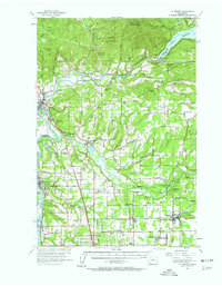
1954 Map of La Center
USGS Topo · Published 1962About this map
The Lewis River and its East Fork carve through this Clark County landscape, defining the boundaries and early economies of mid-century La Center and Woodland. This mid-1950s survey documents a region in transition, where the infrastructure of early settlement—seen in the Grist Mill near Etna and the State Fish Hatchery—remains alongside several decommissioned schoolhouses. Educational history is particularly visible through marked sites like the Enterprise Sch and W Pioneer School, reflecting the consolidation of rural districts as the population shifted toward hubs like Battle Ground. To the north, the massive expanse of Lake Merwin and the Ariel Powerhouse signify the era's hydroelectric developments. Near the Cowlitz River, major rail lines including the Northern Pacific and Union Pacific mirror the path of the Pacific Highway, illustrating the vital transportation corridor connecting the Columbia River to northern settlements.
Find a feature on this map
99 named features on this map. Tap any name to fly to it.
Don’t see what you’re looking for? This feature index may not catch every label — zoom into the map to look around manually.
Map Details
Editions of this 1954 La Center Map
2 editions found
Other maps of this area

1897 · Portland
USGS Topo · 1:62,500

1905 · Portland
USGS Topo · 1:62,500

1915 · Hillsboro
USGS Topo · 1:62,500

1918 · Hillsboro
USGS Topo · 1:62,500

1918 · Troutdale
USGS Topo · 1:62,500

1919 · Mount St Helens
USGS Topo · 1:125,000

1921 · Kalama
USGS Topo · 1:62,500

1922 · St. Helens
USGS Topo · 1:62,500

1934 · Troutdale
USGS Topo · 1:48,000

1940 · Hillsboro
USGS Topo · 1:62,500