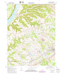
1969 Map of La Grange
USGS Topo · Published 1979About this map
The Ohio River forms the northwestern boundary of this 1969 landscape, where the settlement of Westport sits near the mouth of Eighteenmile Creek. To the southeast, the town of La Grange serves as a center of commerce and transportation, anchored by the Louisville and Nashville railroad line and the County Fairgrounds. The presence of the State Reformatory and its associated Reformatory Lake suggests the historical institutional footprint in the area, while smaller communities like Buckner and Greenhaven dot the rolling terrain.
Find a feature on this map
63 named features on this map. Tap any name to fly to it.
Don’t see what you’re looking for? This feature index may not catch every label — zoom into the map to look around manually.
Map Details
Editions of this 1969 La Grange Map
4 editions found
Other maps of this area

1905 · Prospect
USGS Topo · 1:62,500

1912 · Prospect
USGS Topo · 1:62,500

1932 · La Grange
USGS Topo · 1:62,500

1938 · Owen
USGS Topo · 1:24,000

1939 · Bethlehem
USGS Topo · 1:24,000

1948 · Bethlehem
USGS Topo · 1:24,000

1948 · Owen
USGS Topo · 1:24,000

1951 · Anchorage
USGS Topo · 1:24,000

1951 · Crestwood
USGS Topo · 1:24,000

1953 · Bedford
USGS Topo · 1:24,000