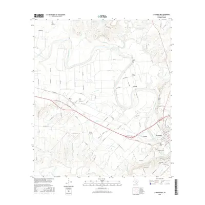
2016 Map of La Grange West
USGS Topo · Published 2016About this map
The Colorado River defines the geography of Fayette County in this survey, winding past the western edge of La Grange and cutting through a landscape of floodplains and bluffs. To the north and west, the terrain rises into the prairies of Rabbs Prairie and Raabe Prairie, where small settlements like Plum and Navidad serve as local hubs. This map is particularly valuable for genealogists, as it documents several rural burial sites including Plum Grove Cem, Williams Family Cem, and Mantan Cem, alongside family-named landmarks like Indian Hill. Transport networks are central to the area's layout, with State Highway 71 Bridge crossing the river and the Fayette Regional Air Center positioned south of Wendt. The southern portion of the sheet is dominated by significant elevations and watercourses, most notably Monument Hill and the confluence of Buckners Cr and O'Quinn Br as they flow toward the primary river valley.
Find a feature on this map
101 named features on this map. Tap any name to fly to it.
Don’t see what you’re looking for? This feature index may not catch every label — zoom into the map to look around manually.
Map Details
Editions of this 2016 La Grange West Map
This is the sole edition of this map. No revisions or reprints were ever made.
Other maps of this area

1885 · Bastrop
USGS Topo · 1:125,000

1893 · Bastrop
USGS Topo · 1:125,000

1901 · Flatonia
USGS Topo · 1:125,000

1904 · Bastrop
USGS Topo · 1:125,000

1919 · Giddings
USGS Topo · 1:62,500

1948 · Smithville
USGS Topo · 1:62,500

1950 · Smithville
USGS Topo · 1:62,500

1953 · Seguin
USGS Topo · 1:250,000

1954 · Austin
USGS Topo · 1:250,000

1956 · La Grange
USGS Topo · 1:62,500