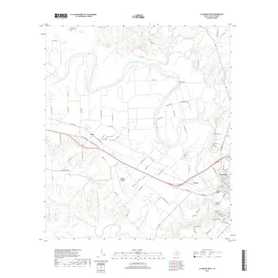
2019 Map of La Grange West
USGS Topo · Published 2019About this map
The Colorado River carves a winding path through this portion of Fayette County, defining a landscape of alluvial prairies and river bluffs northwest of the county seat. The small community of Plum sits along the southern edge of these bottomlands, anchored by Railroad St and the historic Plum Grove Cem. The map illustrates a transition from the agricultural expanses of Rabbs Prairie and Raabe Prairie to the more developed outskirts of La Grange, where the State Highway 71 Bridge crosses the river near Chalk Bluff.
Find a feature on this map
102 named features on this map. Tap any name to fly to it.
Don’t see what you’re looking for? This feature index may not catch every label — zoom into the map to look around manually.
Map Details
Editions of this 2019 La Grange West Map
This is the sole edition of this map. No revisions or reprints were ever made.
Other maps of this area

1885 · Bastrop
USGS Topo · 1:125,000

1893 · Bastrop
USGS Topo · 1:125,000

1901 · Flatonia
USGS Topo · 1:125,000

1904 · Bastrop
USGS Topo · 1:125,000

1919 · Giddings
USGS Topo · 1:62,500

1948 · Smithville
USGS Topo · 1:62,500

1950 · Smithville
USGS Topo · 1:62,500

1953 · Seguin
USGS Topo · 1:250,000

1954 · Austin
USGS Topo · 1:250,000

1956 · La Grange
USGS Topo · 1:62,500