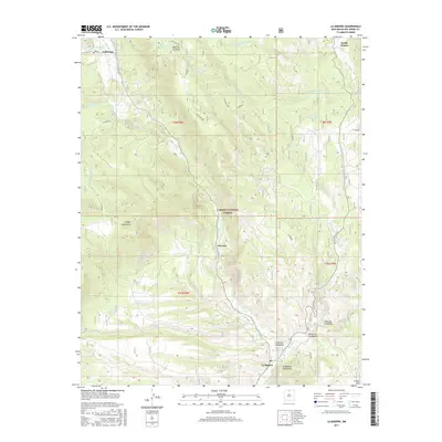
2017 Map of La Madera
USGS Topo · Published 2017About this map
Rio Vallecitos serves as the central artery for this Rio Arriba County landscape, flowing south through a rugged canyon system that defines the local geography. The settlement of Vallecitos sits in the northern reaches of this valley, while La Madera marks the confluence where the river joins the Rio Tusas to form the Rio Ojo Caliente. This area, tucked within the Carson National Forest, reflects a traditional New Mexican pattern of valley-floor settlements situated between high terrain features like the Ortega Mountains and the Mesa de la Jarita.
Find a feature on this map
33 named features on this map. Tap any name to fly to it.
Don’t see what you’re looking for? This feature index may not catch every label — zoom into the map to look around manually.
Map Details
Editions of this 2017 La Madera Map
This is the sole edition of this map. No revisions or reprints were ever made.
Other maps of this area

1918 · Abiquiu
USGS Topo · 1:125,000

1918 · Tusas
USGS Topo · 1:125,000

1953 · Valle Grande Peak
USGS Topo · 1:24,000

1953 · El Rito
USGS Topo · 1:24,000

1953 · La Madera
USGS Topo · 1:24,000

1953 · Ojo Caliente
USGS Topo · 1:24,000

1954 · Raton
USGS Topo · 1:250,000

1954 · Aztec
USGS Topo · 1:250,000

1958 · Raton
USGS Topo · 1:250,000

1958 · Aztec
USGS Topo · 1:250,000