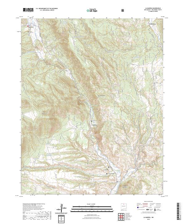
2023 Map of La Madera
USGS Topo · Published 2023About this map
La Madera and the surrounding high-country settlements of Vallecitos and Ancones are situated where the Rio Vallecitos and Rio Tusas converge within the Carson National Forest. This modern record of northern New Mexico shows a landscape of deep canyons and mesas, notably the Mesa de la Jarita and the Ortega Mountains. Genealogists will find a cluster of burial sites, including the Vallecitos Catholic Cemetery, Ancones Cemetery, and Trujillo Cemetery, which reflect the longstanding community ties in this river valley. The map documents the extensive water management infrastructure of the region, identifying numerous catchments like the Burma Trick Tank and Upper Abrevadero Tank that support livestock and local land use. These features, along with forest access routes like Jarita Meza Road, illustrate the persistent intersection of traditional ranching practices and federal forest management.
Find a feature on this map
38 named features on this map. Tap any name to fly to it.
Don’t see what you’re looking for? This feature index may not catch every label — zoom into the map to look around manually.
Map Details
Editions of this 2023 La Madera Map
This is the sole edition of this map. No revisions or reprints were ever made.
Other maps of this area

1918 · Abiquiu
USGS Topo · 1:125,000

1918 · Tusas
USGS Topo · 1:125,000

1953 · Valle Grande Peak
USGS Topo · 1:24,000

1953 · El Rito
USGS Topo · 1:24,000

1953 · La Madera
USGS Topo · 1:24,000

1953 · Ojo Caliente
USGS Topo · 1:24,000

1954 · Raton
USGS Topo · 1:250,000

1954 · Aztec
USGS Topo · 1:250,000

1958 · Raton
USGS Topo · 1:250,000

1958 · Aztec
USGS Topo · 1:250,000