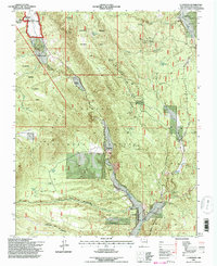
1995 Map of La Madera
USGS Topo · Published 1997About this map
Vallecitos and La Madera anchor this mountainous section of Northern New Mexico, where the Rio Vallecitos carves through the Carson National Forest. The landscape is defined by the Vallecitos Sustained Yield Unit, reflecting a specialized forest management era. High-elevation ranching is represented by Rancho de Trujillo and Rancho de Olguin, while the eastern canyons are marked by an intensive history of mineral extraction.
Find a feature on this map
67 named features on this map. Tap any name to fly to it.
Don’t see what you’re looking for? This feature index may not catch every label — zoom into the map to look around manually.
Map Details
Editions of this 1995 La Madera Map
This is the sole edition of this map. No revisions or reprints were ever made.
Other maps of this area

1918 · Abiquiu
USGS Topo · 1:125,000

1918 · Tusas
USGS Topo · 1:125,000

1953 · Valle Grande Peak
USGS Topo · 1:24,000

1953 · El Rito
USGS Topo · 1:24,000

1953 · La Madera
USGS Topo · 1:24,000

1953 · Ojo Caliente
USGS Topo · 1:24,000

1954 · Raton
USGS Topo · 1:250,000

1954 · Aztec
USGS Topo · 1:250,000

1958 · Raton
USGS Topo · 1:250,000

1958 · Aztec
USGS Topo · 1:250,000