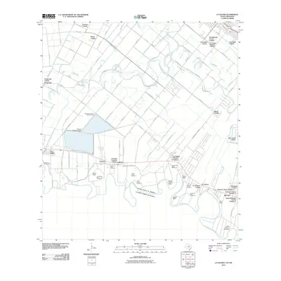
2010 Map of La Paloma
USGS Topo · Published 2010About this map
The Rio Grande snakes through the southern reaches of this landscape, defining the international boundary between the United States of America and Estados Unidos Mexicanos. The map reveals a dense network of colonias and small communities tied to the river's fertile floodplain, including Los Indios, Carricitos, and Ranchito. Water management is central to the area's geography, evidenced by the Harlingen Main Canal, Lateral U Canal, and the reservoir structures of Cameron Company WCID 2 Dam 1 and Dam 2. Numerous named river bends, such as Wentz Bend and Woods Bend, along with historic banco labels like Llanito Banco Number 14, trace the shifting path of the river and the complex land divisions inherent to the Texas-Mexico borderlands.
Find a feature on this map
91 named features on this map. Tap any name to fly to it.
Don’t see what you’re looking for? This feature index may not catch every label — zoom into the map to look around manually.
Map Details
Editions of this 2010 La Paloma Map
This is the sole edition of this map. No revisions or reprints were ever made.
Other maps of this area

1929 · Rio Hondo
USGS Topo · 1:24,000

1929 · Harlingen
USGS Topo · 1:24,000

1929 · Santa Maria
USGS Topo · 1:24,000

1929 · La Feria
USGS Topo · 1:24,000

1929 · La Paloma
USGS Topo · 1:24,000

1930 · West Brownsville
USGS Topo · 1:24,000

1930 · Barreda
USGS Topo · 1:24,000

1932 · Rio Hondo
USGS Topo · 1:31,680

1932 · Harlingen
USGS Topo · 1:31,680

1936 · La Feria
USGS Topo · 1:31,680