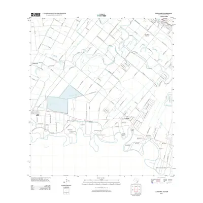
2013 Map of La Paloma
USGS Topo · Published 2013About this map
Rio Grande meanders along the international border in this 2013 survey, defining a landscape of agricultural infrastructure and historic land tracts. The map records several named bancos, such as Llanito Banco Number 14, Capote Banco Number 13, and Rosita Banco Number 73, which reflect the complex history of river channel shifts and subsequent land adjustments. These unique features sit alongside sharp river bends like Wentz Bend and Woods Bend.
Find a feature on this map
136 named features on this map. Tap any name to fly to it.
Don’t see what you’re looking for? This feature index may not catch every label — zoom into the map to look around manually.
Map Details
Editions of this 2013 La Paloma Map
This is the sole edition of this map. No revisions or reprints were ever made.
Other maps of this area

1929 · Rio Hondo
USGS Topo · 1:24,000

1929 · Harlingen
USGS Topo · 1:24,000

1929 · Santa Maria
USGS Topo · 1:24,000

1929 · La Feria
USGS Topo · 1:24,000

1929 · La Paloma
USGS Topo · 1:24,000

1930 · West Brownsville
USGS Topo · 1:24,000

1930 · Barreda
USGS Topo · 1:24,000

1932 · Rio Hondo
USGS Topo · 1:31,680

1932 · Harlingen
USGS Topo · 1:31,680

1936 · La Feria
USGS Topo · 1:31,680