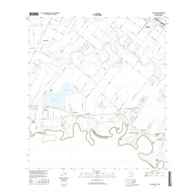
2016 Map of La Paloma
USGS Topo · Published 2016About this map
The Rio Grande snakes along the international border in this 2016 survey of Cameron County, forming a series of dramatic oxbows including Wentz Bend, Wright Kingery Bend, and Keller Esparza-Vera Bend. This agricultural landscape is defined by an intricate network of irrigation, including the Harlingen Main Canal and Lateral U Canal, which support the small communities and colonias scattered throughout the Rio Grande Valley. Settlements like La Paloma and Los Indios are situated between the river and the southern outskirts of San Benito. To the west, the Lrgv NWR preserves native habitat alongside the Cameron Company WCID 2 Reservoir 1, illustrating the region's careful balance of water management and conservation. Notable family-named points and small rural clusters such as El Calabozo Colonia, Carricitos, and Landrum provide specific geographic markers for those tracing local heritage in this borderland corridor.
Find a feature on this map
144 named features on this map. Tap any name to fly to it.
Don’t see what you’re looking for? This feature index may not catch every label — zoom into the map to look around manually.
Map Details
Editions of this 2016 La Paloma Map
This is the sole edition of this map. No revisions or reprints were ever made.
Other maps of this area

1929 · Rio Hondo
USGS Topo · 1:24,000

1929 · Harlingen
USGS Topo · 1:24,000

1929 · Santa Maria
USGS Topo · 1:24,000

1929 · La Feria
USGS Topo · 1:24,000

1929 · La Paloma
USGS Topo · 1:24,000

1930 · West Brownsville
USGS Topo · 1:24,000

1930 · Barreda
USGS Topo · 1:24,000

1932 · Rio Hondo
USGS Topo · 1:31,680

1932 · Harlingen
USGS Topo · 1:31,680

1936 · La Feria
USGS Topo · 1:31,680