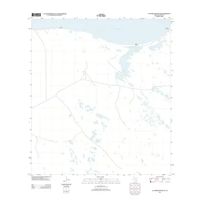
2013 Map of La Parra Ranch NE
USGS Topo · Published 2013About this map
Baffin Bay dominates the northern shoreline of this Kenedy County coastal landscape, where the tides meet a series of low-lying terrain features. Along the water, Pie de Gallo and Black Bluff define the transition between the bay and the interior ranch lands. The settlement at Los Corrallos sits near the northeastern edge of the sheet, providing a rare point of habitation in this expansive environment. This 2013 survey illustrates the modern configuration of the shoreline and the scattered seasonal pools and ephemeral water bodies that characterize the region. The map reveals the intricate network of unimproved roads and 4WD tracks that provide access through the open terrain, reflecting the area's continued use for large-scale ranching and coastal management in the early twenty-first century.
Find a feature on this map
4 named features on this map. Tap any name to fly to it.
Don’t see what you’re looking for? This feature index may not catch every label — zoom into the map to look around manually.
Map Details
Editions of this 2013 La Parra Ranch NE Map
This is the sole edition of this map. No revisions or reprints were ever made.
Other maps of this area

1928 · Sarita
USGS Topo · 1:125,000

1950 · Corpus Christi
USGS Topo · 1:250,000

1951 · Point Of Rocks
USGS Topo · 1:24,000

1951 · Kleberg Point
USGS Topo · 1:24,000

1951 · Sarita 4 NE
USGS Topo · 1:24,000

1951 · South Bird Island
USGS Topo · 1:62,500

1952 · Potrero Cortado
USGS Topo · 1:24,000

1952 · Riviera Beach
USGS Topo · 1:24,000

1952 · La Parra Ranch
USGS Topo · 1:24,000

1952 · Yarborough Pass
USGS Topo · 1:24,000