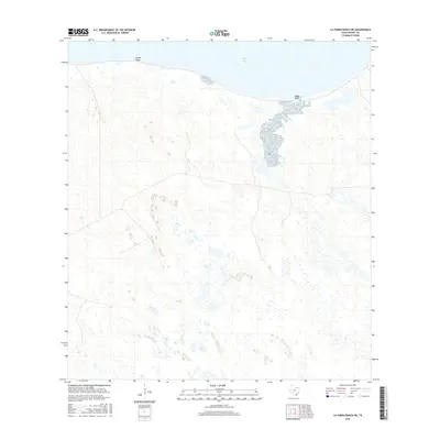
2016 Map of La Parra Ranch NE
USGS Topo · Published 2016About this map
Baffin Bay dominates the northern edge of this coastal reach, where the waters of the Gulf of Mexico inlet meet a complex network of wetlands and tidal flats. The terrain is defined by localized elevations and shoreline features such as Pie de Gallo in the northwest and Black Bluff further east. This 2016 survey illustrates the remote character of Kenedy County, showing a landscape largely devoid of concentrated settlements and defined instead by natural hydrology and subtle topographic changes. The presence of numerous small ponds and depressions across the interior suggests a dynamic coastal environment where seasonal water levels significantly influence the geography of the local ranch lands.
Find a feature on this map
3 named features on this map. Tap any name to fly to it.
Don’t see what you’re looking for? This feature index may not catch every label — zoom into the map to look around manually.
Map Details
Editions of this 2016 La Parra Ranch NE Map
This is the sole edition of this map. No revisions or reprints were ever made.
Other maps of this area

1928 · Sarita
USGS Topo · 1:125,000

1950 · Corpus Christi
USGS Topo · 1:250,000

1951 · Point Of Rocks
USGS Topo · 1:24,000

1951 · Kleberg Point
USGS Topo · 1:24,000

1951 · Sarita 4 NE
USGS Topo · 1:24,000

1951 · South Bird Island
USGS Topo · 1:62,500

1952 · Potrero Cortado
USGS Topo · 1:24,000

1952 · Riviera Beach
USGS Topo · 1:24,000

1952 · La Parra Ranch
USGS Topo · 1:24,000

1952 · Yarborough Pass
USGS Topo · 1:24,000