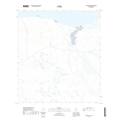
2019 Map of La Parra Ranch NE
USGS Topo · Published 2019About this map
Baffin Bay dominates the northern reaches of this coastal Texas landscape, where the tides meet a complex network of wetlands and tidal flats. Along the southern shoreline of the bay, Black Bluff stands as a notable landmark on the edge of the Kenedy County ranchlands. This 2019 survey documents a largely undeveloped stretch of the Gulf Coast, characterized by intermittent water bodies like Pie de Gallo and numerous unpaved ranch roads that snake through the brush and sandy terrain. The map's detail on ephemeral water and wetland distribution illustrates the shifting nature of this sensitive coastal environment, providing a modern baseline for researchers interested in the preservation of the Texas shoreline and the management of these historic cattle ranch territories.
Find a feature on this map
3 named features on this map. Tap any name to fly to it.
Don’t see what you’re looking for? This feature index may not catch every label — zoom into the map to look around manually.
Map Details
Editions of this 2019 La Parra Ranch NE Map
This is the sole edition of this map. No revisions or reprints were ever made.
Other maps of this area

1928 · Sarita
USGS Topo · 1:125,000

1950 · Corpus Christi
USGS Topo · 1:250,000

1951 · Point Of Rocks
USGS Topo · 1:24,000

1951 · Kleberg Point
USGS Topo · 1:24,000

1951 · Sarita 4 NE
USGS Topo · 1:24,000

1951 · South Bird Island
USGS Topo · 1:62,500

1952 · Potrero Cortado
USGS Topo · 1:24,000

1952 · Riviera Beach
USGS Topo · 1:24,000

1952 · La Parra Ranch
USGS Topo · 1:24,000

1952 · Yarborough Pass
USGS Topo · 1:24,000