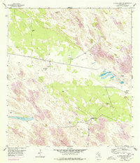
1954 Map of La Parra Ranch SW
USGS Topo · Published 1978About this map
Shifting sand dunes dominate this section of the Kenedy County coastline, where the landscape is defined by the constant movement of earth and the search for water. The area is characterized by a sparse network of ranching and industrial outposts, centered around Marana Camp and several distinctive grazing enclosures known as traps, such as the Marana Trap and Padre Juanito Trap.
Find a feature on this map
24 named features on this map. Tap any name to fly to it.
Don’t see what you’re looking for? This feature index may not catch every label — zoom into the map to look around manually.
Map Details
Editions of this 1954 La Parra Ranch SW Map
2 editions found
Other maps of this area

1923 · Armstrong
USGS Topo · 1:62,500

1923 · Saltillo Ranch
USGS Topo · 1:62,500

1928 · Sarita
USGS Topo · 1:125,000

1950 · Corpus Christi
USGS Topo · 1:250,000

1951 · Sarita 4 NE
USGS Topo · 1:24,000

1952 · La Parra Ranch
USGS Topo · 1:24,000

1952 · Sarita 4 SE
USGS Topo · 1:24,000

1953 · Brownsville
USGS Topo · 1:250,000

1954 · La Parra Ranch SW
USGS Topo · 1:24,000

1954 · Sarita
USGS Topo · 1:62,500