
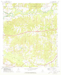
1971 Map of La Place
USGS Topo · Published 1973About this map
The Tuskegee Air Force Base (Abandoned) Sharpe Field anchors the northeast corner of this landscape, a significant site of military history situated near the winding course of Uphapee Creek. The topography is defined by the drainage systems of the Tallapoosa River and Calebee Creek, where the Western Railway of Alabama runs parallel to the river valley through the small settlement of Franklin.
Find a feature on this map
36 named features on this map. Tap any name to fly to it.
Don’t see what you’re looking for? This feature index may not catch every label — zoom into the map to look around manually.
Map Details
Editions of this 1971 La Place Map
2 editions found
Other maps of this area

1906 · Dadeville
USGS Topo · 1:125,000

1955 · Phenix City
USGS Topo · 1:250,000

1957 · Phenix City
USGS Topo · 1:250,000

1958 · Phenix City
USGS Topo · 1:250,000

1971 · Carrville
USGS Topo · 1:24,000
1971 · Tallassee
USGS Topo · 1:24,000

1971 · Tuskegee
USGS Topo · 1:24,000

1971 · Shorter
USGS Topo · 1:24,000
1971 · Notasulga
USGS Topo · 1:24,000

1971 · Hardaway
USGS Topo · 1:24,000