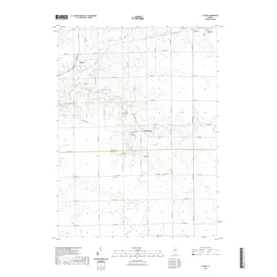
2021 Map of La Rose
USGS Topo · Published 2021About this map
La Rose and Pattonsburg anchor this agrarian landscape near the Marshall and Woodford county line. The map reveals a dense network of local history markers, particularly cemeteries that serve as vital records for family researchers. From the Trinity Lutheran Cem near La Rose to the Bell Plain Baptist Cem and Hollenback Cem, these sites are dispersed among the headwaters of South Branch Crow Creek and Hallenback Cr. The township's rectilinear road grid, defined by routes like LaRose Rd and Pattonsburg Rd, is interrupted only by the winding paths of Snag Cr and Snake Cr. In the northeast corner, a portion of Toluca appears, showing the transition from village plots to the surrounding agricultural sections in the early 21st century.
Find a feature on this map
59 named features on this map. Tap any name to fly to it.
Don’t see what you’re looking for? This feature index may not catch every label — zoom into the map to look around manually.
Map Details
Editions of this 2021 La Rose Map
This is the sole edition of this map. No revisions or reprints were ever made.
Other maps of this area

1893 · Lacon
USGS Topo · 1:62,500

1893 · Metamora
USGS Topo · 1:62,500

1933 · Lacon
USGS Topo · 1:62,500

1934 · Wenona
USGS Topo · 1:48,000

1937 · Metamora
USGS Topo · 1:62,500

1937 · Lacon
USGS Topo · 1:62,500

1939 · Wenona
USGS Topo · 1:62,500

1948 · Metamora
USGS Topo · 1:62,500

1955 · Minonk
USGS Topo · 1:62,500

1958 · Aurora
USGS Topo · 1:250,000