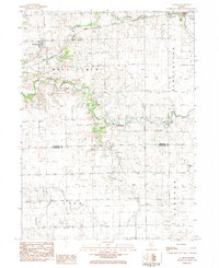
1983 Map of La Rose
USGS Topo · Published 1984About this map
The Atchison Topeka And Santa Fe railway anchors the village of La Rose in this corner of central Illinois, where the prairie transitions into the drainage basins of the North Branch Crow Creek and South Branch Crow Creek. The landscape is a study in rural settlement patterns across the Bell Plain, Bennington, and Linn townships. This 1980s snapshot records several family and community burial grounds, including the Hallenback Cem, Davidson Cem, and Trinity Cem. Near the edge of Toluca, a solitary Mineshaft and the St Anne Cem mark the outskirts of town. The presence of the Davison Landing Strip and the Tall Oaks Country Club reflects the modernization of the local landscape alongside traditional landmarks like the Township Hall.
Find a feature on this map
24 named features on this map. Tap any name to fly to it.
Don’t see what you’re looking for? This feature index may not catch every label — zoom into the map to look around manually.
Map Details
Editions of this 1983 La Rose Map
This is the sole edition of this map. No revisions or reprints were ever made.
Other maps of this area

1893 · Lacon
USGS Topo · 1:62,500

1893 · Metamora
USGS Topo · 1:62,500

1933 · Lacon
USGS Topo · 1:62,500

1934 · Wenona
USGS Topo · 1:48,000

1937 · Metamora
USGS Topo · 1:62,500

1937 · Lacon
USGS Topo · 1:62,500

1939 · Wenona
USGS Topo · 1:62,500

1948 · Metamora
USGS Topo · 1:62,500

1955 · Minonk
USGS Topo · 1:62,500

1958 · Aurora
USGS Topo · 1:250,000