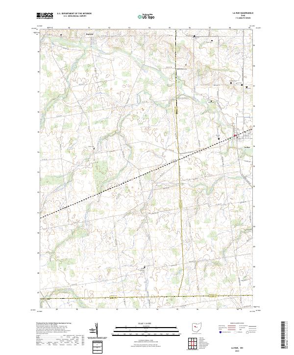
2023 Map of La Rue
USGS Topo · Published 2023About this map
The Scioto River snakes through the agricultural landscape of northern Marion County, defining the northern edge of this rural region. The village of La Rue serves as the primary hub in the east, where the local road network converges at the junction of the Larue Kenton Rd and Richwood Larue Rd. Smaller settlements like Hepburn punctuate the northern townships, which are marked by a dense grid of township and county roads.
Find a feature on this map
75 named features on this map. Tap any name to fly to it.
Don’t see what you’re looking for? This feature index may not catch every label — zoom into the map to look around manually.
Map Details
Editions of this 2023 La Rue Map
This is the sole edition of this map. No revisions or reprints were ever made.
Other maps of this area

1913 · East Liberty
USGS Topo · 1:62,500

1913 · Richwood
USGS Topo · 1:62,500

1915 · Richwood
USGS Topo · 1:62,500

1915 · East Liberty
USGS Topo · 1:62,500

1915 · Kenton
USGS Topo · 1:62,500

1915 · La Rue
USGS Topo · 1:62,500

1944 · East Liberty
USGS Topo · 1:62,500

1944 · Kenton
USGS Topo · 1:62,500

1944 · Richwood
USGS Topo · 1:62,500

1950 · Marion
USGS Topo · 1:250,000