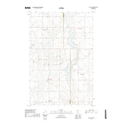
2019 Map of La Salle Lake
USGS Topo · Published 2019About this map
The Mississippi River winds through the glaciated landscapes of Clearwater and Hubbard counties in this modern topographic record. The settlement of Vern and the community at Lake Itasca serve as primary points of reference in a region defined by its complex hydrology and wetland systems. The map details a chain of major water bodies including Big LaSalle Lake, Middle LaSalle Lake, and the smaller LaSalle Lake, all connected by the drainage of LaSalle Cr.
Find a feature on this map
44 named features on this map. Tap any name to fly to it.
Don’t see what you’re looking for? This feature index may not catch every label — zoom into the map to look around manually.
Map Details
Editions of this 2019 La Salle Lake Map
This is the sole edition of this map. No revisions or reprints were ever made.
Other maps of this area

1954 · Bemidji
USGS Topo · 1:250,000

1957 · Bemidji
USGS Topo · 1:250,000

1958 · Bemidji
USGS Topo · 1:250,000

1969 · Anchor Hill
USGS Topo · 1:24,000

1969 · Heart Lake
USGS Topo · 1:24,000
1969 · Upper Rice Lake
USGS Topo · 1:24,000

1972 · Alida
USGS Topo · 1:24,000

1972 · La Salle Lake
USGS Topo · 1:24,000
1972 · Grant Lake
USGS Topo · 1:24,000
1972 · Lake Itasca
USGS Topo · 1:24,000