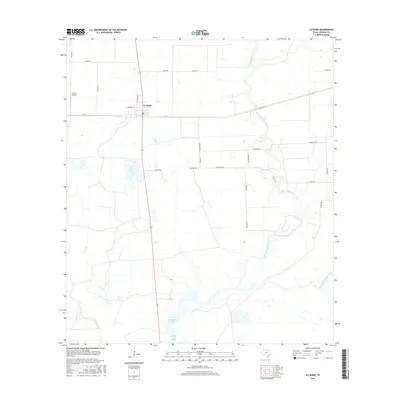
2016 Map of La Ward
USGS Topo · Published 2016About this map
La Ward stands at the intersection of Fm 616 and State Highway 172, serving as a primary settlement in this coastal Texas landscape. The map illustrates a rural economy organized around a grid of county roads, such as Revel Rd and Maynard Rd, which partition the low-lying terrain north of Carancahua Bay. The hydrology of the region is defined by the winding paths of West Carancahua Creek and East Carancahua Creek, which meander toward the marshy coastal interfaces of the Gulf of Mexico. To the west, the drainage of Keller Cr further shapes the topography. Notable local infrastructure includes Whites Airport, positioned along the western edge of the survey area, reflecting the importance of private aviation in managing these expansive agricultural and coastal lands.
Find a feature on this map
29 named features on this map. Tap any name to fly to it.
Don’t see what you’re looking for? This feature index may not catch every label — zoom into the map to look around manually.
Map Details
Editions of this 2016 La Ward Map
This is the sole edition of this map. No revisions or reprints were ever made.
Other maps of this area

1952 · Francitas NW
USGS Topo · 1:24,000

1952 · Manson
USGS Topo · 1:24,000

1952 · Point Comfort
USGS Topo · 1:24,000

1952 · Olivia
USGS Topo · 1:24,000

1952 · Turtle Bay
USGS Topo · 1:24,000

1952 · Francitas
USGS Topo · 1:24,000

1952 · Francitas NE
USGS Topo · 1:24,000

1952 · La Ward
USGS Topo · 1:24,000

1952 · Lolita
USGS Topo · 1:24,000

1953 · Beeville
USGS Topo · 1:250,000