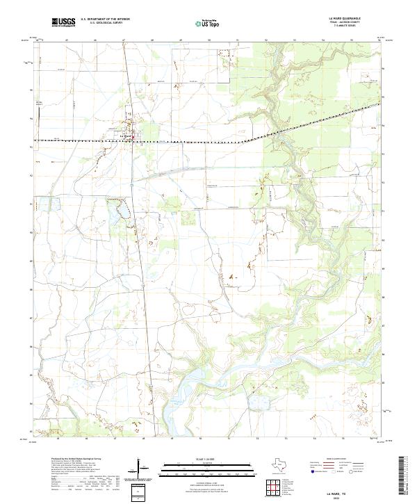
2022 Map of La Ward
USGS Topo · Published 2022About this map
La Ward sits at the intersection of FM 616 and Ganado Ave, serving as the primary settlement in this coastal Texas landscape. The geography is defined by the complex drainage systems of West Carancahua Creek and East Carancahua Creek, which flow southward toward the headwaters of Carancahua Bay. To the west, the winding path of Keller Creek further carves the terrain. Transportation is dominated by a grid of rural county roads such as Revel Rd and Francitas Rd, alongside smaller local thoroughfares like Refugio St and Howard Ave. A notable point of private aviation, Whites Airport, is situated in the northwest, punctuating a landscape otherwise devoted to the wide expanses of Jackson County prairie and coastal marshland.
Find a feature on this map
28 named features on this map. Tap any name to fly to it.
Don’t see what you’re looking for? This feature index may not catch every label — zoom into the map to look around manually.
Map Details
Editions of this 2022 La Ward Map
This is the sole edition of this map. No revisions or reprints were ever made.
Other maps of this area

1952 · Francitas NW
USGS Topo · 1:24,000

1952 · Manson
USGS Topo · 1:24,000

1952 · Point Comfort
USGS Topo · 1:24,000

1952 · Olivia
USGS Topo · 1:24,000

1952 · Turtle Bay
USGS Topo · 1:24,000

1952 · Francitas
USGS Topo · 1:24,000

1952 · Francitas NE
USGS Topo · 1:24,000

1952 · La Ward
USGS Topo · 1:24,000

1952 · Lolita
USGS Topo · 1:24,000

1953 · Beeville
USGS Topo · 1:250,000