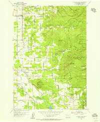
1954 Map of Lacamas Creek
USGS Topo · Published 1956About this map
Hockinson and Proebstel serve as central hubs in this mid-century landscape, which is defined by a complex network of drainage systems and agricultural development. The presence of China Ditch and Big Ditch highlights a history of water management designed to transform the low-lying areas near Mill Plain and Fern Prairie. The terrain rises sharply to the east toward Livingston Mtn and Elkhorn Mtn, creating a varied environment where timbered slopes meet established valley settlements.
Find a feature on this map
40 named features on this map. Tap any name to fly to it.
Don’t see what you’re looking for? This feature index may not catch every label — zoom into the map to look around manually.
Map Details
Editions of this 1954 Lacamas Creek Map
4 editions found
Other maps of this area

1897 · Portland
USGS Topo · 1:62,500

1905 · Portland
USGS Topo · 1:62,500

1918 · Troutdale
USGS Topo · 1:62,500

1934 · Troutdale
USGS Topo · 1:48,000

1940 · Portland
USGS Topo · 1:62,500

1940 · La Center
USGS Topo · 1:62,500

1941 · Yacolt
USGS Topo · 1:62,500

1941 · Camas
USGS Topo · 1:62,500

1942 · Camas
USGS Topo · 1:62,500

1948 · Vancouver
USGS Topo · 1:250,000