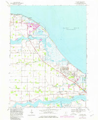
1967 Map of Lacarne
USGS Topo · Published 1980About this map
The coastal marshes and wetlands of Ottawa County define this landscape along Lake Erie, where the expansive Ottawa National Wildlife Refuge and the Little Portage River Wildlife Area dominate the shoreline. The map illustrates a region deeply connected to the water, from the industrial and military presence at Camp Perry to the small lakeside communities of Long Beach and Sand Beach. Inland, the terrain is structured by drainage systems like Rusha Creek and Lacarpe Creek, which feed into the Toussaint River and Portage River.
Find a feature on this map
31 named features on this map. Tap any name to fly to it.
Don’t see what you’re looking for? This feature index may not catch every label — zoom into the map to look around manually.
Map Details
Editions of this 1967 Lacarne Map
2 editions found
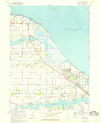
Other maps of this area

1900 · Oak Harbor
USGS Topo · 1:62,500

1901 · Put-In-Bay
USGS Topo · 1:62,500

1901 · Bellevue
USGS Topo · 1:62,500

1901 · Fremont
USGS Topo · 1:62,500

1903 · Bellevue
USGS Topo · 1:62,500

1903 · Fremont
USGS Topo · 1:62,500

1903 · Put In Bay
USGS Topo · 1:62,500

1952 · Oak Harbor
USGS Topo · 1:24,000

1952 · Lacarne
USGS Topo · 1:24,000

1952 · Oak Harbor
USGS Topo · 1:62,500