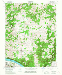
1966 Map of Laconia
USGS Topo · Published 1977About this map
Laconia serves as the central hub for this portion of southern Harrison County during the mid-1960s, surrounded by a landscape defined by its proximity to the Ohio River. The southern border of the map follows the river's bend, where Tobacco Landing remains a visible link to the area's maritime and agricultural transport history. The uplands are dotted with small rural communities and civic markers, from the South Central School and Union Chapel to the Old Goshen Cemetery, which reflect long-standing family settlements in Boone and Webster townships.
Find a feature on this map
36 named features on this map. Tap any name to fly to it.
Don’t see what you’re looking for? This feature index may not catch every label — zoom into the map to look around manually.
Map Details
Editions of this 1966 Laconia Map
3 editions found
Other maps of this area

1909 · Kosmosdale
USGS Topo · 1:48,000

1912 · Kosmosdale
USGS Topo · 1:62,500

1931 · Corydon
USGS Topo · 1:62,500

1936 · Vine Grove
USGS Topo · 1:62,500

1941 · Ekron
USGS Topo · 1:62,500

1943 · Vine Grove
USGS Topo · 1:62,500

1944 · Corydon West
USGS Topo · 1:24,000

1946 · Rock Haven
USGS Topo · 1:24,000

1946 · Fort Knox
USGS Topo · 1:24,000

1946 · Vine Grove
USGS Topo · 1:62,500