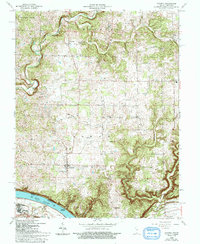
1966 Map of Laconia
USGS Topo · Published 1999About this map
Laconia serves as the central hub for this Harrison County landscape, situated on the high ground north of a dramatic bend in the Ohio River. The mapping reveals a rural community deeply rooted in its local institutions, evidenced by the high concentration of country churches and burial grounds such as St Michaels Ch, Rehoboth Ch, and the Old Goshen Cem. The terrain transitions from the relatively level agricultural lands around Dogwood to the deeply dissected ravines leading toward the river, where prominent features like Hogback Ridge dominate the topography.
Find a feature on this map
35 named features on this map. Tap any name to fly to it.
Don’t see what you’re looking for? This feature index may not catch every label — zoom into the map to look around manually.
Map Details
Editions of this 1966 Laconia Map
3 editions found
Other maps of this area

1909 · Kosmosdale
USGS Topo · 1:48,000

1912 · Kosmosdale
USGS Topo · 1:62,500

1931 · Corydon
USGS Topo · 1:62,500

1936 · Vine Grove
USGS Topo · 1:62,500

1941 · Ekron
USGS Topo · 1:62,500

1943 · Vine Grove
USGS Topo · 1:62,500

1944 · Corydon West
USGS Topo · 1:24,000

1946 · Rock Haven
USGS Topo · 1:24,000

1946 · Fort Knox
USGS Topo · 1:24,000

1946 · Vine Grove
USGS Topo · 1:62,500