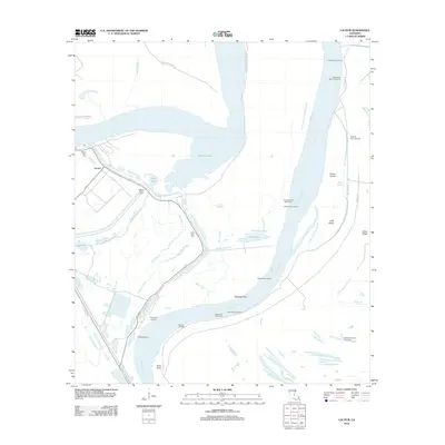
2012 Map of Lacour
USGS Topo · Published 2012About this map
Mississippi River landings and complex bayou networks define this riverine landscape in Pointe Coupee Parish. The settlement of Lacour serves as a focal point near the northern edge, where Mount Zion Cem and Mount Olive Cem provide critical touchpoints for genealogical research. The river's influence is evident in the numerous revetments and landings, such as Iowa Point Landing and Sebastopol Landing, which historically facilitated the movement of goods and people along the water.
Find a feature on this map
41 named features on this map. Tap any name to fly to it.
Don’t see what you’re looking for? This feature index may not catch every label — zoom into the map to look around manually.
Map Details
Editions of this 2012 Lacour Map
This is the sole edition of this map. No revisions or reprints were ever made.
Other maps of this area

1906 · Bayou Sara
USGS Topo · 1:125,000

1939 · St. Francisville
USGS Topo · 1:62,500

1939 · Fordoche
USGS Topo · 1:62,500

1941 · Batchelor
USGS Topo · 1:62,500

1953 · New Roads
USGS Topo · 1:24,000

1954 · Baton Rouge
USGS Topo · 1:250,000

1955 · Fordoche
USGS Topo · 1:62,500

1955 · Batchelor
USGS Topo · 1:62,500

1956 · Baton Rouge
USGS Topo · 1:250,000

1959 · Fordoche
USGS Topo · 1:62,500