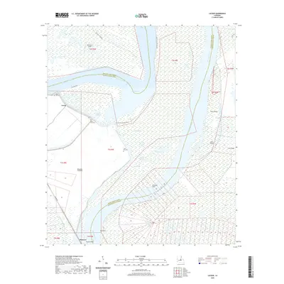
2020 Map of Lacour
USGS Topo · Published 2020About this map
The Mississippi River snakes through this portion of Pointe Coupee and West Feliciana Parishes, defining a complex landscape of shifting channels and low-lying islands. Modern water control is evident in the expansive Morganza Floodway, designed to protect downstream areas during high water events. The settlement of Morganza sits at the edge of this system, near the bend of the river at Morgans Bend.
Find a feature on this map
41 named features on this map. Tap any name to fly to it.
Don’t see what you’re looking for? This feature index may not catch every label — zoom into the map to look around manually.
Map Details
Editions of this 2020 Lacour Map
This is the sole edition of this map. No revisions or reprints were ever made.
Other maps of this area

1906 · Bayou Sara
USGS Topo · 1:125,000

1939 · St. Francisville
USGS Topo · 1:62,500

1939 · Fordoche
USGS Topo · 1:62,500

1941 · Batchelor
USGS Topo · 1:62,500

1953 · New Roads
USGS Topo · 1:24,000

1954 · Baton Rouge
USGS Topo · 1:250,000

1955 · Fordoche
USGS Topo · 1:62,500

1955 · Batchelor
USGS Topo · 1:62,500

1956 · Baton Rouge
USGS Topo · 1:250,000

1959 · Fordoche
USGS Topo · 1:62,500