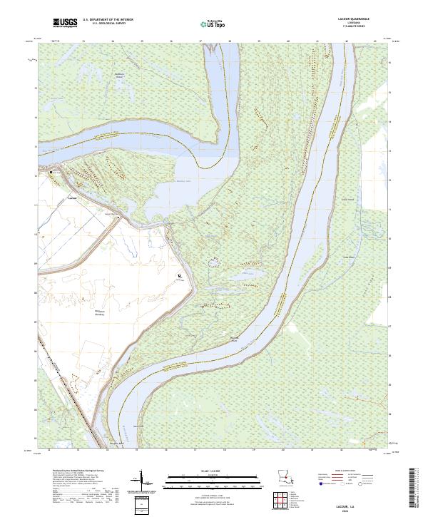
2024 Map of Lacour
USGS Topo · Published 2024About this map
Mississippi River meanders define this section of the Louisiana river parishes, where the shifting channel has left behind complex oxbows and islands. The landscape is dominated by the Cat Island National Wildlife Refuge and the Morganza Floodway, illustrating the massive engineering and conservation efforts required to manage the river's path. In the community of Lacour, several cemeteries including Mount Zion Cem and Mount Olive Cem offer critical clues for genealogists researching family ties in West Feliciana and Pointe Coupee Parishes. The presence of Raccourci Island and the Raccourci Old River loop highlights the historical isolation of these river-locked lands, while Old River Lndg marks a point of access to these water-dependent environments.
Find a feature on this map
42 named features on this map. Tap any name to fly to it.
Don’t see what you’re looking for? This feature index may not catch every label — zoom into the map to look around manually.
Map Details
Editions of this 2024 Lacour Map
This is the sole edition of this map. No revisions or reprints were ever made.
Other maps of this area

1906 · Bayou Sara
USGS Topo · 1:125,000

1939 · St. Francisville
USGS Topo · 1:62,500

1939 · Fordoche
USGS Topo · 1:62,500

1941 · Batchelor
USGS Topo · 1:62,500

1953 · New Roads
USGS Topo · 1:24,000

1954 · Baton Rouge
USGS Topo · 1:250,000

1955 · Fordoche
USGS Topo · 1:62,500

1955 · Batchelor
USGS Topo · 1:62,500

1956 · Baton Rouge
USGS Topo · 1:250,000

1959 · Fordoche
USGS Topo · 1:62,500