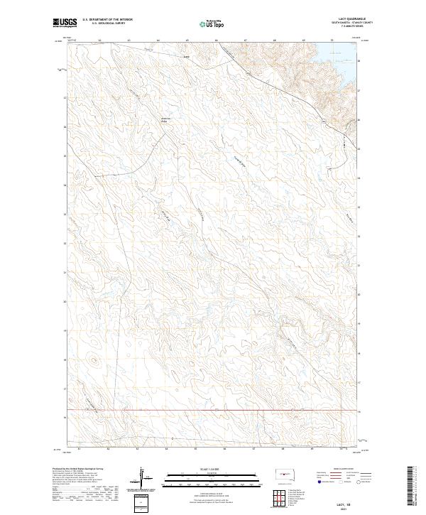
2021 Map of Lacy
USGS Topo · Published 2021About this map
Lacy sits atop the high ground of Stanley County in this contemporary study of South Dakota's river-cut landscape. The map highlights the significant drainage systems feeding into the Missouri River, which forms part of Lake Oahe in the northeastern corner of the sheet. The terrain is characterized by a series of prominent ridges and erosional features, most notably Anderson Ridge, which is flanked by numerous named draws including Huckfeldt Draw, Casey Draw, and True Draw. These landforms dictate the local road network, with routes like Mission Ridge Rd and Sansarc Rd traversing the higher elevations. The intricate network of seasonal waterways, such as Willow Cr and Ash Cr, illustrates the hydrological patterns typical of the region's semi-arid environment, providing a detailed record of the physical geography near the river's edge.
Find a feature on this map
18 named features on this map. Tap any name to fly to it.
Don’t see what you’re looking for? This feature index may not catch every label — zoom into the map to look around manually.
Map Details
Editions of this 2021 Lacy Map
This is the sole edition of this map. No revisions or reprints were ever made.
Other maps of this area

1937 · Oahe
USGS Topo · 1:62,500

1953 · Teton
USGS Topo · 1:24,000

1953 · Oahe SW
USGS Topo · 1:24,000

1954 · Pierre
USGS Topo · 1:250,000

1958 · Pierre
USGS Topo · 1:250,000
1973 · Iron Post Buttes SE
USGS Topo · 1:24,000

1973 · Iron Post Buttes SW
USGS Topo · 1:24,000
1973 · Willow Creek Butte
USGS Topo · 1:24,000

1980 · Princes Ranch
USGS Topo · 1:25,000
1982 · Doty Ridge
USGS Topo · 1:24,000