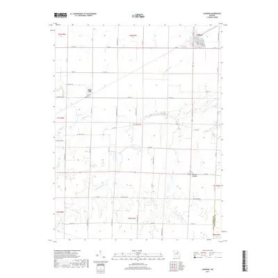
2017 Map of Laddonia
USGS Topo · Published 2017About this map
Laddonia serves as the primary hub of this Audrain County landscape, situated where the grid of the local road network meets the natural drainage systems of the Missouri plains. The town's detailed street plan, including N Pine St and Walnut St, highlights a concentrated residential and commercial core surrounded by expansive agricultural tracts. To the west, the smaller settlement of Rush Hill sits along State Hwy B, while the crossing at Scotts Corner marks a key junction to the south.
Find a feature on this map
67 named features on this map. Tap any name to fly to it.
Don’t see what you’re looking for? This feature index may not catch every label — zoom into the map to look around manually.
Map Details
Editions of this 2017 Laddonia Map
This is the sole edition of this map. No revisions or reprints were ever made.
Other maps of this area

1890 · Mexico
USGS Topo · 1:125,000

1932 · Mexico
USGS Topo · 1:62,500

1942 · Wellsville
USGS Topo · 1:62,500

1945 · Florida
USGS Topo · 1:62,500

1945 · Perry
USGS Topo · 1:62,500

1948 · Quincy
USGS Topo · 1:250,000

1956 · Quincy
USGS Topo · 1:250,000
1972 · Mexico East
USGS Topo · 1:24,000
1972 · Santa Fe
USGS Topo · 1:24,000
1972 · Mexico SE
USGS Topo · 1:24,000