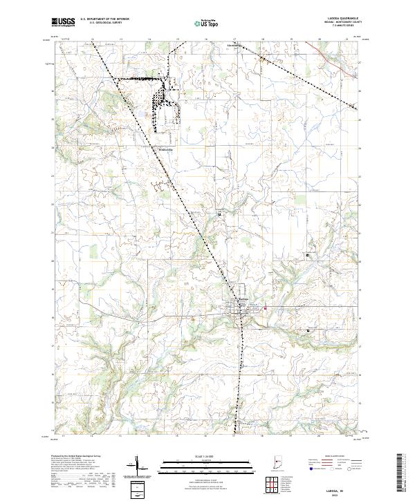
2022 Map of Ladoga
USGS Topo · Published 2022About this map
Ladoga anchors the southern portion of this Montgomery County landscape, where a dense grid of streets like E Main St and N Cherry St meet the surrounding agricultural plains. The drainage of Big Raccoon Creek and its various tributaries, including Little Raccoon Cr and Cornstalk Cr, create the primary relief in an otherwise strictly surveyed section of Indiana. Settlement patterns follow the established township lines, with smaller communities such as Whitesville and Linnsburg situated near rail and road corridors. For those tracing local families, the map preserves the locations of several burial sites, including Harshbarger Cem, Inlow Cem, and Stoner Cem. These sites, often located near the creek bends, offer a link to the early pioneers who established the farmsteads that still define this rural region south of the county seat.
Find a feature on this map
70 named features on this map. Tap any name to fly to it.
Don’t see what you’re looking for? This feature index may not catch every label — zoom into the map to look around manually.
Map Details
Editions of this 2022 Ladoga Map
This is the sole edition of this map. No revisions or reprints were ever made.
Other maps of this area

1953 · Danville
USGS Topo · 1:250,000

1953 · Indianapolis
USGS Topo · 1:250,000

1955 · Danville
USGS Topo · 1:250,000

1955 · Russellville
USGS Topo · 1:24,000

1956 · Danville
USGS Topo · 1:250,000

1956 · Indianapolis
USGS Topo · 1:250,000

1956 · Crawfordsville
USGS Topo · 1:24,000

1956 · New Market
USGS Topo · 1:24,000

1957 · Indianapolis
USGS Topo · 1:250,000

1957 · New Ross
USGS Topo · 1:24,000