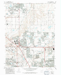
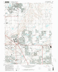
1965 Map of Lafayette
USGS Topo · Published 1994About this map
Lafayette and Louisville anchor the northwestern reaches of this survey, where the Coal Creek Valley transitions from open terrain to suburban development. The landscape is dotted with evidence of earlier industry, including several marked Mine Dump sites that reflect the area's history of coal mining. The agricultural and water management heritage of the region is visible through an extensive network of irrigation and storage, notably Waneka Reservoir, Hecla Lake, and Stearns Lake.
Find a feature on this map
107 named features on this map. Tap any name to fly to it.
Don’t see what you’re looking for? This feature index may not catch every label — zoom into the map to look around manually.
Map Details
Editions of this 1965 Lafayette Map
5 editions found
Other maps of this area

1890 · East Denver
USGS Topo · 1:125,000

1899 · West Denver
USGS Topo · 1:125,000

1902 · Greeley
USGS Topo · 1:125,000

1904 · Niwot
USGS Topo · 1:62,500

1938 · Derby
USGS Topo · 1:24,000

1939 · Golden
USGS Topo · 1:24,000

1940 · Eastlake
USGS Topo · 1:31,680

1940 · Lafayette
USGS Topo · 1:31,680

1940 · Derby
USGS Topo · 1:31,680

1941 · Arvada
USGS Topo · 1:31,680