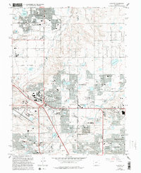
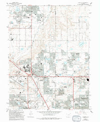
1965 Map of Lafayette
USGS Topo · Published 1994About this map
Lafayette and Louisville anchor this mid-1960s study, which documents a landscape transitioning from its coal-mining roots toward the suburban expansion of the North Denver metro area. The presence of the Burlington Northern railroad and several remaining Mine Dump sites alongside growing residential developments like Wallace Village reflects this era of shifting land use. Industrial activity remains visible at the Gravel Pit near Rock Creek, while the aviation needs of the period are centered at the Jeffco Airport and its associated Radio Facility.
Find a feature on this map
89 named features on this map. Tap any name to fly to it.
Don’t see what you’re looking for? This feature index may not catch every label — zoom into the map to look around manually.
Map Details
Editions of this 1965 Lafayette Map
5 editions found
Other maps of this area

1890 · East Denver
USGS Topo · 1:125,000

1899 · West Denver
USGS Topo · 1:125,000

1902 · Greeley
USGS Topo · 1:125,000

1904 · Niwot
USGS Topo · 1:62,500

1938 · Derby
USGS Topo · 1:24,000

1939 · Golden
USGS Topo · 1:24,000

1940 · Eastlake
USGS Topo · 1:31,680

1940 · Lafayette
USGS Topo · 1:31,680

1940 · Derby
USGS Topo · 1:31,680

1941 · Arvada
USGS Topo · 1:31,680